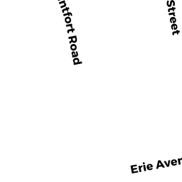
73 ERIE AVE
Owner Information
HOOKER MARK & JOANNE
73 ERIE AVE
NEWTON, MA 02461


Property Details
73 ERIE AVE is classified as a Single Family Residential (Victorian).
The primary structure on this property was built in 1900. There are 4,924ft2 of built area within this property. There is 3,217ft2 of residential/living space within this property. This property is listed as having 9 rooms.
73 ERIE AVE is valued at $1,667,200. The land is valued at $638,300 and the structures are valued at $1,028,900.
This property is in Zone SR2. Confirm with local Zoning Board authorities to ensure there are no overlays or other easements on this property.
The most recent deed for 73 ERIE AVE is recorded at the local registrar in Book 32776, Page 288. 73 ERIE AVE was last sold on Sunday, April 1, 2001 for $975,000.
Assessment data from fiscal year 2022.
Flood Data
According to the FEMA National Flood Hazard Layer, this property does not appear to be in a flood zone. It may also be in an area not yet reviewed. Nonetheless, confirm this information prior to taking any action.
To view the flood hazards around this property, create a FEMA "Firmette" Map of the area around 73 ERIE AVE.
Broadband Internet Providers
| Provider | Type | Bandwidth (mbps) | |
|---|---|---|---|
| GCI Communication Corp. | Satellite | 0 | 0 |
| T-Mobile | Fixed Wireless | 25 | 3 |
| RCN | Cable | 500 | 20 |
| Comcast | Cable | 1000 | 35 |
| Verizon New England Inc. | Fiber | 940 | 880 |
| Verizon New England Inc. | DSL | 5 | 0 |
| Viasat Inc | Satellite | 100 | 3 |
| VSAT Systems, LLC. | Satellite | 2 | 1 |
| HughesNet | Satellite | 25 | 3 |
Broadband service provider data from December 2020.
Adjacent Properties
- 69 ERIE AVE 1
Residential Condominium owned by NG CHRISTOPHER KWOK WAI - 71 ERIE AVE 2
Residential Condominium owned by HEIM S MARK & MELISSA L - 69-71 ERIE AVE
Other, Open Space owned by 69-71 ERIE AVE MASTER DEED - 77 ERIE AVE
Single Family Residential owned by JACOBSON ROBERT A & JESSICA BLOCK - 138 LINCOLN ST #1
Residential Condominium owned by GRAGG HANA & DOUGLAS L - 138 LINCOLN ST
Other, Open Space owned by 138 LINCOLN STREET MASTER DEED - 138 LINCOLN ST #2
Residential Condominium owned by BISWAS JHILAM - 130 LINCOLN ST
Two-Family Residential owned by BARING-GOULD JONATHAN